CWS Forecast: Northwest Pennsylvania
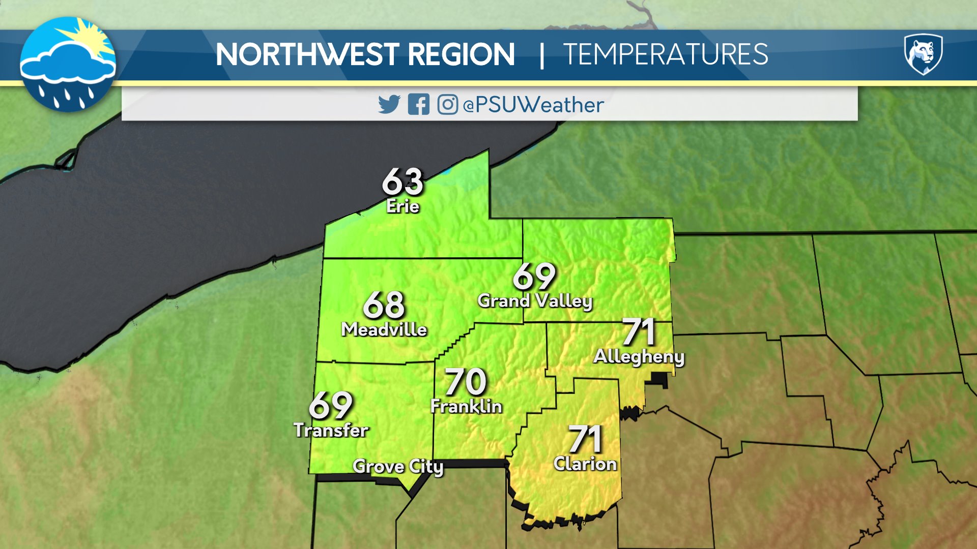
Midweek will begin comfortably across Pennsylvania with widespread 70s across virtually the entire state. Dry weather with relatively few clouds is expected. Thursday looks similar temperature-wise. although perhaps a touch cooler north and warmer south compared to Wednesday. However, the skies will be somewhat unsettled as some showers and storms can be expected, particularly north of I-76. Friday’s forecast is a somewhat difficult one as there is strong disagreement on the extent of rain, but as of now, it looks like at least the later part of the day, perhaps overnight, will feature rain across southern and western areas. Temperatures, however, look to continue to remain between 70 and 80 degrees. Heading into the weekend, chances for showers are present in southern areas both days, but the comfortable temperatures look to continue aside from slightly cooler temperature where rain is persistent. However, temperatures look to return to above average next week as humidity surges back into the region, likely bringing chances for severe weather in the process.
Day One: Wednesday, June 24th 2026


Periods of rain during the day, partly cloudy overnight. Cool.
High: 46°F
Low: 36°F
Day Two: Thursday, June 25th 2026

Remaining cool with mostly clear skies.
High: 49°F
Low: 37°F
Day Three: Friday, June 26th 2026
Mostly sunny and a little warmer during the day, partly cloudy overnight.
High: 54°F
Low: 46°F
Day Four: Saturday, June 27th 2026

Warmer with increasing clouds and rain chances. Thunderstorms possible overnight.
High: 64°F
Low: 55°F
Day Five: Sunday, June 28th 2026
Periods of rain likely throughout the day, with thunder possible.
High: 62°F
Low: 47°F

